


All Issues
How to study cannabis
Publication Information
California Agriculture 71(2):53-54. https://doi.org/10.3733/ca.2017a0012
Published online April 12, 2017
Summary
Van Butsic is pioneering the study of how California's richest crop affects rural landscapes.
Full text
Soon after Van Butsic arrived in California in 2013 to join UC Agriculture and Natural Resources, he noticed a pattern.
“Fire, water and weed are the three land-use issues that come up no matter who I talk to in this state,” he said.
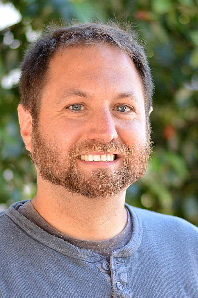
UCCE Assistant Specialist Van Butsic uses satellite imagery to analyze the environmental impacts of cannabis production.
Fire and water were well-covered by UC and other researchers already. But cannabis looked to be an unexploited niche.
So Butsic, a UC Cooperative Extension (UCCE) assistant specialist in land systems science in the UC Berkeley Department of Environmental Science, Policy and Management, decided to build part of his research portfolio around understanding the scope, intensity and landscape impacts of cannabis cultivation in California (a research paper from another area of his research, ecosystem service valuation, appears on page 81 of this issue).
While the environmental impacts of cannabis production have drawn substantial media attention, and though it is by many estimates the state's most valuable crop, data beyond anecdotes is scarce.
Butsic attacked the problem by visually analyzing satellite-based imagery, identifying remote plantations and greenhouses in Humboldt County and mapping them using GIS.
This approach required many hundreds of hours of manual inspection of satellite images, and one of the first challenges was figuring out how to do this labor-intensive work. It wasn't difficult to find UC Berkeley undergraduates interested in working for course credit. Nearly 25 students have now contributed to the project, and two (so far) have moved on to full-time GIS jobs after graduation. An anonymous nonprofit organization provided financial support for a part-time staff researcher and to purchase more recent high-resolution satellite data.
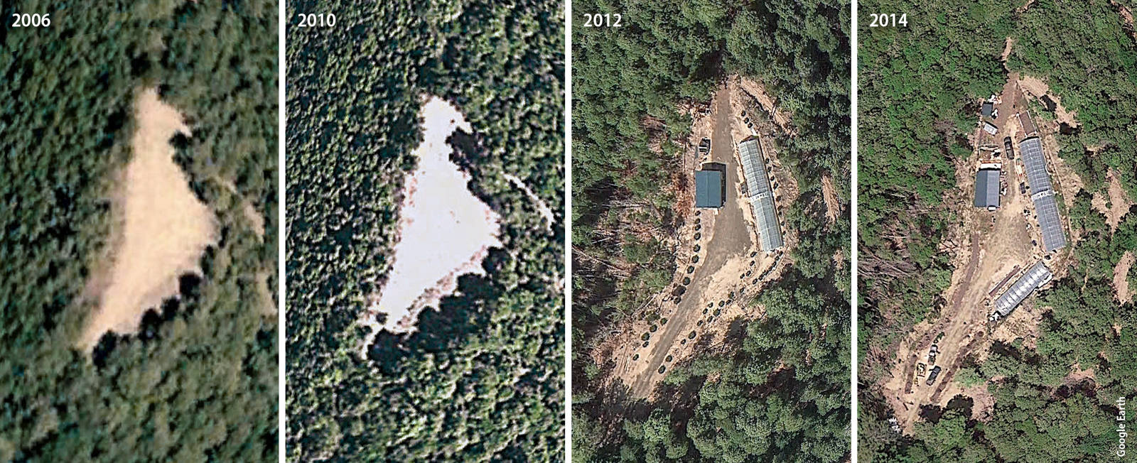
This series of satellite images shows the development of a greenhouse complex in a Humboldt County forest. Using satellite imagery in combination with GIS layers showing topopgraphy, watercourses, zoning and other variables, Butsic and his colleagues can characterize cannabis production sites in a variety of ways, such as average slope, proximity to streams, and whether they are located on land zoned for agriculture.
The team has built a GIS data layer for about half of Humboldt County's land area, identifying roughly 300,000 cannabis plants (equivalent to a wholesale value of perhaps $150 million) based on 2012 imagery, with an updated estimate now in the works. The data layer enables a variety of analyses — from the zoning of the land used by cannabis growers (only about a quarter of the 1,429 grows identified were on land zoned for agriculture); to the slope of cannabis production plots, a factor influencing erosion (almost a quarter are on very steep ground, with slope exceeding 30%); to proximity to salmon streams (more than 200 grows were found within 100 meters of critical habitat for steelhead and chinook salmon) (Butsic and Brenner 2016).
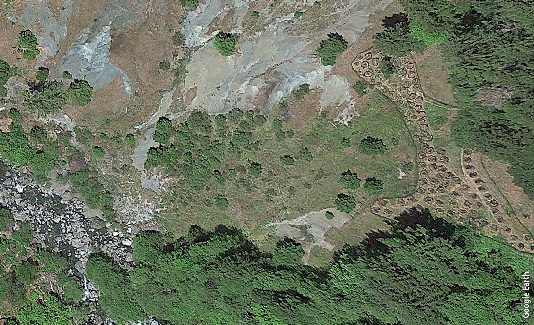
Butsic and his colleagues identified approximately 4,400 grow sites in their research. Five percent of those, including the site pictured above, were within 100 meters of salmon streams.
Butsic estimates the absolute volume of water used to irrigate cannabis to be fairly modest — on the order of a few thousand acre-feet. But that figure probably understates the habitat impact of water diversions; water is withdrawn from small watersheds during summer months when water is scarce, and some creeks are known to have been completely dewatered.
The information is helping to inform local debates. Humboldt County recently adopted an ordinance requiring all new cannabis grows to be developed on land zoned for agriculture (existing grows on nonagricultural land are grandfathered in). This policy raises concerns about rapid inflation of agricultural land, as cannabis growers bid up prices beyond what other farm or livestock operations can support. Butsic's work provides insights into the characteristics and geography of lands that are likely to be developed for cannabis production.
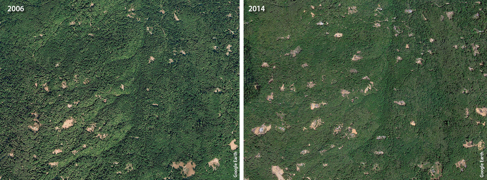
Forest fragmentation occurs when cannabis growers clear land and build roads to access their grow sites. The Butsic team's analysis indicates that 68% of grows were located more than 500 meters from developed roads.
Related to this issue, Butsic and several Humboldt County–based UCCE academics — County Director Yana Valachovic, Area Fire Advisor Lenya Quinn-Davidson, and Livestock and Natural Resources Advisor Jeffery Stackhouse — are currently surveying Humboldt County landowners about cannabis-related land use issues.
Butsic's next steps include continued mapping of cannabis production in California, with Mendocino County to be completed by the end of 2017. Given the uncertainty around federal restrictions on cannabis production under the Trump administration, Butsic said it's difficult to predict what the most essential research questions surrounding cannabis will be. Nonetheless, “by continuing to document on the ground patterns of cannabis production, we will be in a position to answer those questions,” he said.
How to study cannabis

